Active Swaps: Speed Routes Around Our Borough
Wave goodbye to traffic jams and make the most of our borough’s many footpaths and shortcuts. Choosing an active journey over driving not only boosts your physical activity levels, helping you achieve the 150 minutes of physical activity a week recommended by the NHS, but also leads to savings on fuel costs while contributing to a reduction in air pollution.
As part of our Active Swaps campaign, we’ve created Speed Route maps to simplify your navigation through the town via walking, wheeling, scooting or cycling. Our maps reveal that opting for an active commute can even be faster than driving during peak times! Explore the evidence yourself…
Speed Route: Montague Park Development (Samborne Drive) to Peach Street, Wokingham
Tire out your little ones with playtime in Plough Lane Play Area and then get 25 minutes of mood-boosting walking into your day.


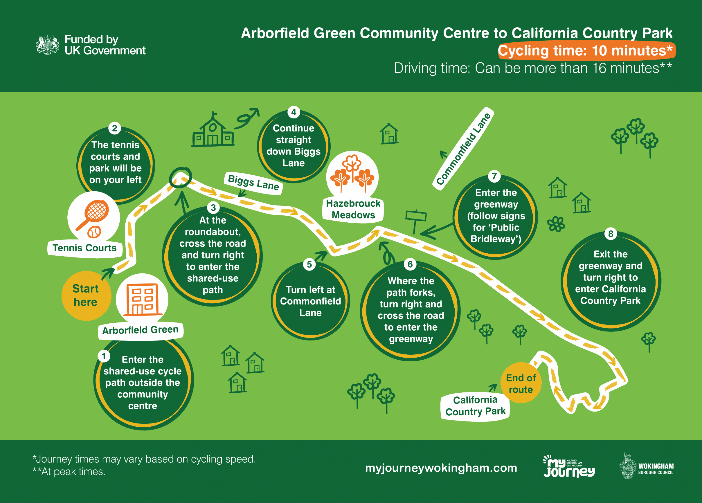
Speed Route: Arborfield Green Community Centre to California Country Park
A 10-minute cycle is sure to get your heart pumping. Plus, you might catch a glimpse of Wokingham’s next Roger Federer on this route!


Speed Route: Copsewood to Wokingham Train Station
Got a train to catch? Get to the station faster by bicycle.


Speed Route: Shinfield Meadows Playground to School Green Centre
Get to School Green Centre and avoid the car fumes by going via Parker Close.
Speed Route: Maiden Erlegh to Woodley
You can shave 3 minutes off your journey to Woodley by cycling!

Speed Route: Woosehill to Wokingham
Get from Woosehill to Wokingham in half the time by taking your bicycle!

Speed Route: Arborfield Green to Henry Street Garden Centre, Arborfield
Going to Henry Street Garden Centre? Make use of the shared-use paths along the way. Remember to take care when cycling on the road!

Speed Route: Wokingham Hospital to Wokingham Town Hall
While travelling to the Town Hall may be quicker by car (by a matter of minutes), once you factor in parking time, walking could be the faster option.

Speed Route: FBC Centre to California Crossroads
It only takes 4 minutes to cycle from the FBC Centre to California Crossroads. Avoid sitting in traffic and feel healthier by choosing active travel.

Speed Route: Maiden Place Community Centre to Loddon Valley Leisure Centre
Enjoy a quick 7 minute cycle ride to the Loddon Valley Leisure Centre to warm up for a day of activities.

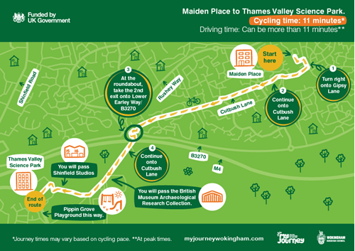
Speed Route: Maiden Place to Thames Valley Science Park
Cycling to Thames Valley Science Park can take the same amount of time as driving. Why not save money on petrol and take a healthier route?

Speed Route: Shinfield (Hollow Lane) to the Emmbrook School
Enjoy some quality time with your children by cycling to the Emmbrook School. Opting to cycle instead of taking the car when you can helps the roads around schools to be safer and clearer.

We developed these speed route maps to highlight the great infrastructure our borough offers for walking and cycling to the town’s most frequented destinations. Our maps are all available to download from the 'related downloads' section on this page.
If you have a more specific route in mind, why not use the Journey Planner where you can plot your next journey and see the best route options for getting there by bicycle or on foot.
You may also want to make use of the Live Bus Map for slightly longer journeys.
We hope you have everything you need to incorporate more active swaps into your routine. If you have any doubts about active travel, be sure to read about The Importance of Active Swaps.

